November 4, 2026
How Satellite Map Camera Placement Improves CCTV Planning
By @satellitemapcameranotes
When I started designing surveillance systems over a decade ago, most of the planning happened on paper or in clunky desktop software that required importing CAD files. You would drive to a site, take measurements, sketch sightlines, and then go back to the office to piece it all together. That process worked, but it left a lot of room for error. A tree you missed, a roofline that blocked half the field of view, a light pole that threw glare into the lens. Over time, satellite imagery changed everything. What used to take days can now be done in an hour, and the accuracy is often good enough for 90 percent of the work. The key is understanding how to use satellite map camera placement properly.
Satellite map camera placement is the practice of using high-resolution aerial or satellite imagery to position security cameras virtually before you ever set foot on the site. You drop a pin, draw a field of view, and see exactly what that camera will capture. It turns a guessing game into a data-driven exercise. And because you can overlay multiple cameras on the same map, you can check for coverage gaps, overlapping zones, and blind spots without leaving your desk. For anyone who designs CCTV systems for a living, this approach saves time, reduces site visits, and makes proposals more convincing.
Why Satellite Imagery Works for Camera Planning
The obvious advantage is that you get a bird’s-eye view of the property. But not all satellite images are created equal. The resolution, the age of the image, and the angle of the shot all affect what you can see. A satellite imagery provider like Maxar delivers images with enough detail to spot individual cars, roof vents, and even license plate numbers under ideal conditions. Other sources, like Google Maps or Bing Maps, aggregate imagery from multiple providers and sometimes use older datasets. That matters when you are trying to gauge whether a new fence or a construction crane will block a camera’s line of sight.
I have had jobs where the satellite image showed a parking lot that had been repaved and restriped six months earlier. The map overlay on my screen looked nothing like the current layout. In those cases, the satellite image still gave me the building footprint and the general geography, but I had to rely on GIS coordinates and on-site photos to refine the camera positions. The lesson is that satellite map camera placement works best when you treat it as a starting point, not a final answer. You still need to verify the real-world conditions, but you can eliminate most of the guesswork upfront.
Choosing the Right Map Platform
Different platforms give you different levels of control. Google Maps is probably the most familiar interface. It integrates well with many planning tools and offers decent satellite imagery for most urban areas. Its strength is ease of use. You can pan, zoom, and drop markers without any training. But if you need precise measurements or the ability to adjust for terrain, you may find it limiting.
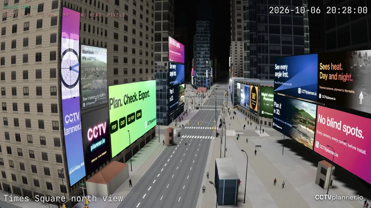
OpenStreetMap, on the other hand, is not a satellite imagery source itself, but it provides incredibly detailed vector data that you can overlay on top of satellite images. That data includes building outlines, road widths, and even footpaths. When you combine OpenStreetMap with a satellite view, you get a richer picture of the site. I have used it to identify alleyways and service entrances that were not obvious from the satellite image alone.
For heavy-duty planning, ArcGIS and QGIS are the professional standards. They let you layer multiple data sources, adjust map scale, and perform spatial analysis. You can import your camera FOV as a polygon, calculate exact coverage areas, and export the results as a report. The downside is the learning curve. If you are a security consultant who just needs to place a dozen cameras around a warehouse, ArcGIS is overkill. A lighter tool like Leaflet, which is a JavaScript library for interactive maps, can be embedded into a browser-based planning tool without requiring the user to install anything. That is where the flexibility shines.
Understanding Accuracy and Its Limits
Satellite images look precise, but they are not perfect. The GPS accuracy of a typical consumer-grade image is around five to ten meters. That means a camera icon you place on the map might actually be five meters north of where you think it is. For wide-angle overview cameras, that error is usually acceptable. For a narrow lens targeting a specific door or a license plate reader, it can be a problem.
Parallax error is another hidden issue. Satellite images are taken from a camera that is not directly above every point on the ground. Tall buildings lean away from the camera’s focal point, creating a displacement that shifts their rooflines. If you draw a camera FOV that relies on the edge of a roof, you might misjudge the sightline by several feet. Photogrammetry can correct some of that distortion by using multiple overlapping images and ground control points to create a rectified orthoimage. But not every satellite imagery provider offers that level of correction. Maxar does for its premium products. Google Maps often does not for its free tier.
I learned this the hard way on a job where I placed a camera on a satellite map to cover a loading dock. The image showed a clear view. On site, a column that was hidden under the roof overhang blocked half the dock. The satellite angle had masked it. Now I always check the elevation data and, if available, use street-level imagery to confirm the vertical clearance.
Geotagging and Workflow Integration
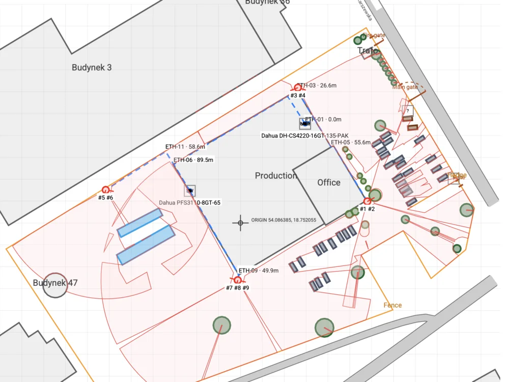
Geotagging is the process of attaching geographic coordinates to a photo or a point of interest. In CCTV planning, you can geotag your proposed camera locations directly on the map. When you visit the site, you pull up those same coordinates on your phone or GPS device and stand exactly where the camera will go. It eliminates the back-and-forth of trying to match a printed map to a physical location.
I have used geotagged waypoints to mark utility poles for pole-mounted cameras, door frames for entryway lenses, and even the center of a parking lot for a wide-area PTZ. The combination of satellite map camera placement and field geotagging gives you a feedback loop. You plan on the map, verify on site, and then update the plan with corrections. Over time, your estimates get faster and more accurate because you build a mental library of how satellite views translate to real sightlines.
Resolution Bandwidth and Practical Constraints
Not every job needs a Maxar-grade image. Sometimes a lower-resolution image from Bing Maps is perfectly fine, especially if you are planning for a rural property where the main features are fences and gates. The resolution bandwidth you need depends on the smallest object you care about. For general surveillance, one-meter resolution is often enough. For license plate recognition, you want sub-30-centimeter resolution, and even then you need the camera to be physically close to the plate, not just the satellite image to be sharp.
I once worked on a school campus that had a mix of old buildings and new construction. The satellite image from two years ago showed the old cafeteria still standing. The new one had been built fifty feet to the east. If I had relied solely on that image, I would have placed cameras pointing at the wrong building. I had to cross-reference the image with recent survey data and Earth observation updates from the local planning department. That extra step took an hour but saved a reinstallation that would have cost days.
Making the Case to Clients
When you present a proposal that includes a map overlay with camera cones and coverage areas, clients immediately understand the value. They can see exactly what each camera will cover. They can point at a blind spot and ask you to fix it before the system goes in. It builds trust. And because you did the work on a satellite map first, you can generate a professional-looking export without needing to draw anything by hand.
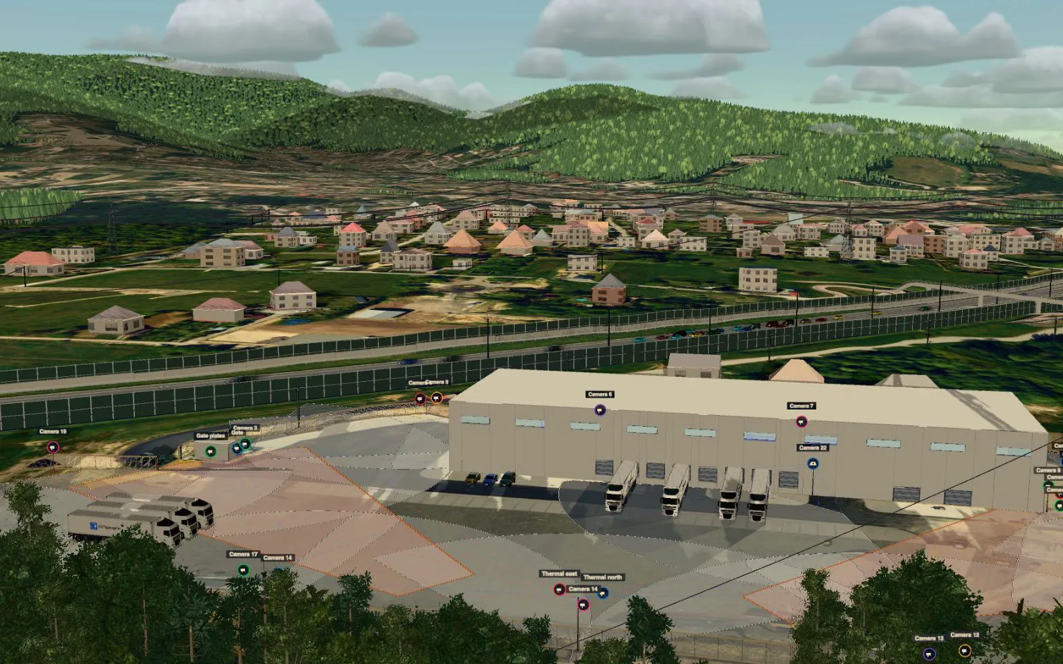
Tools like CCTVplanner make that process straightforward by combining satellite imagery, camera FOV calculations, and export features into a single interface. You do not need to jump between Google Maps, a spreadsheet, and a drawing program. Everything lives in the browser. The satellite map camera placement step becomes the backbone of the design, not an afterthought.
At the end of the day, satellite-based planning is a skill like any other. The more you use it, the better you get at reading the image, accounting for the errors, and knowing when to trust the map and when to walk the ground. It does not replace site surveys, but it makes them faster and more focused. And for a profession where time is money, that is the real payoff.
❧